
On the climb to the Kara-Batkak glacier in the summer of 2025, the route went up a slope of forty-five degrees through coniferous forest before it reached the alpine meadows. We were carrying a twenty-five-kilogram battery, a solar panel and a long metal mast to a gateway site five hundred vertical metres above the valley. The forest was the stretch of the route between us and the install point.
Most of our work in the mountains has been like that. The instruments go to the glaciers and the lakes, and the forests are what we walk through to get there. This autumn we turned the satellite record around and looked at the forests themselves.
People in Kyrgyzstan go out to the mountains and the forests in every season, and most of all in autumn, when the leaves turn yellow and red. Instagram reels and TikTok pages fill up with those landscapes. I love those trips myself. We wanted to tell the same story another way, with measurements of which forest turns the most golden, when each one peaks, and where the autumn leaves last longest.
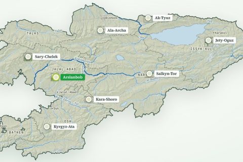
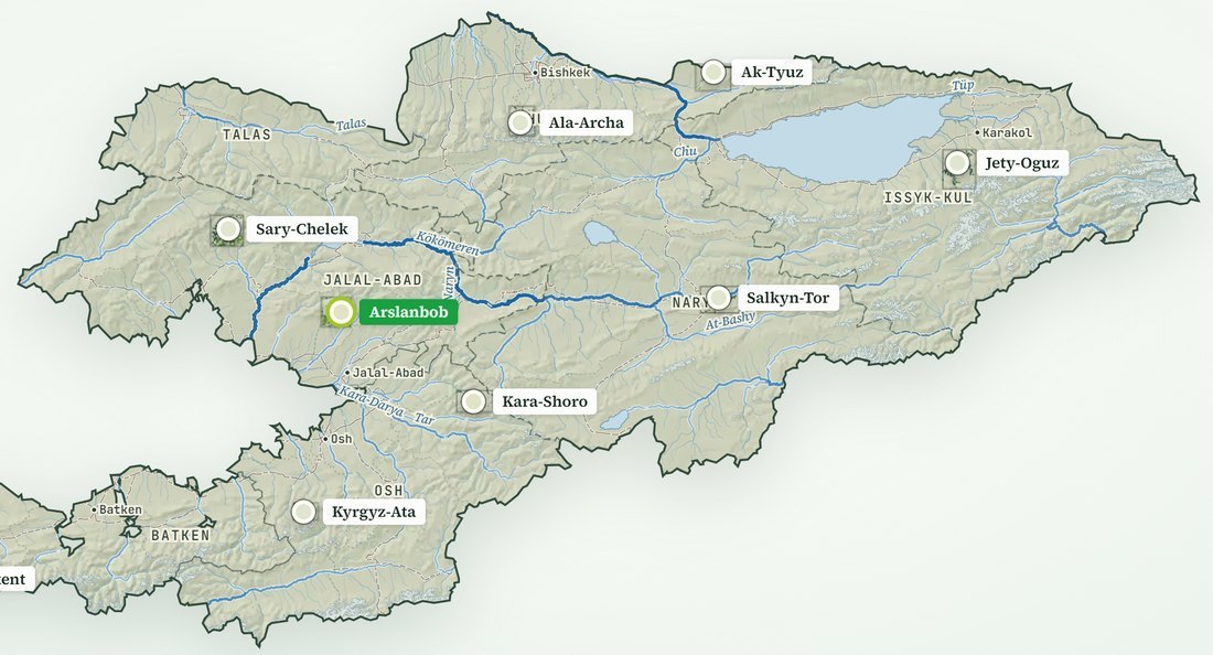
Nine forests in the atlas
The Kyrgyz Forest Atlas follows nine forests in seven regions through every autumn the satellites have recorded. For each forest, every tree pixel that was green in summer gets a leaf stage in each window: green, gold, orange, red, leaves down, snow, or evergreen. Recent years use Sentinel-2 pictures blended over each half-month. Earlier years use Landsat, blended over each month, back to 1990. Altogether that is 916 leaf-stage maps over 61,684 hectares of trees.
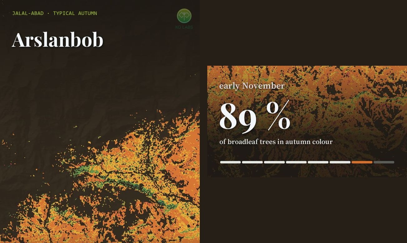
The first thing the maps show is that a single national date for autumn does not exist. Salkyn-Tor in Naryn reaches its most colourful half-month in late September and is bare by late October. Arslanbob in Jalal-Abad reaches its peak in early November. About six weeks separate the first forest from the last.
| Forest (region) | Forest altitude | Evergreen share | Typical peak | Broadleaf trees in colour at peak | Red share of the colour |
|---|---|---|---|---|---|
| Salkyn-Tor (Naryn) | 2,472–3,177 m | 55 % | late September | 54 % | 14 % |
| Sarkent (Batken) | 1,963–2,998 m | 30 % | late September | 70 % | 10 % |
| Ala-Archa (Chuy) | 1,864–2,695 m | 44 % | early October | 66 % | 6 % |
| Ak-Tyuz (Chuy, Kemin) | 1,806–2,754 m | 43 % | early October | 68 % | 30 % |
| Jety-Oguz (Issyk-Kul) | 2,202–3,008 m | 72 % | early October | 29 % | 4 % |
| Kara-Shoro (Osh) | 1,842–2,938 m | 16 % | early October | 63 % | 18 % |
| Kyrgyz-Ata (Osh) | 2,361–3,070 m | 35 % | early October | 63 % | 10 % |
| Sary-Chelek (Jalal-Abad) | 1,322–2,422 m | 26 % | early November | 57 % | 22 % |
| Arslanbob (Jalal-Abad) | 1,272–1,920 m | 1 % | early November | 89 % | 3 % |
Typical autumn from Sentinel-2 half-month composites at 40 m, 2018–2025. Evergreen share is spruce, fir and juniper as a share of each forest’s trees. Tree cover from ESA WorldCover 2021; elevations from Copernicus GLO-30. Source: KG Labs, Kyrgyz Forest Atlas, October 2026.
Height explains much of the order. The two forests that turn last are also the lowest, with Arslanbob’s trees between about 1,300 and 1,900 metres. Salkyn-Tor, the first to turn, grows between about 2,500 and 3,200 metres. Within any one forest the colour runs downhill through the autumn and back uphill in spring. Sary-Chelek shows this inside a single reserve. Above 1,800 metres its broadleaf trees peak in early October. Below 1,800 metres, along the lake shore, they peak in early November.
Autumn colours by forest
The second thing the maps show is that each forest has its own palette, set by the trees that grow there.
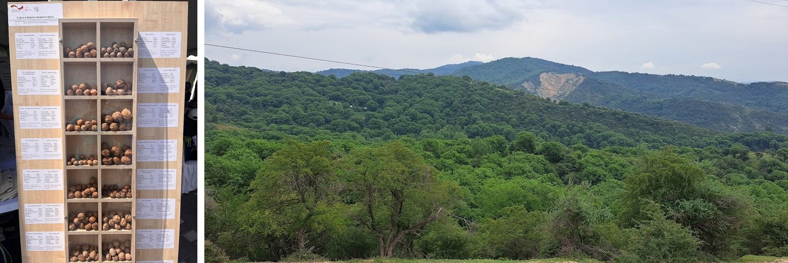
Arslanbob, the walnut-fruit forest, has almost no evergreen trees. At its peak 89 per cent of its broadleaf trees are in colour, more than any other forest we follow, and the colour is mostly orange. Orange makes up 66 per cent of it, gold 31 per cent, and red only 3.
Ak-Tyuz, in the high Kemin valleys, is the red forest. Red is 30 per cent of its autumn colour, the highest share among the nine. Sary-Chelek, where walnut and wild fruit meet spruce and fir, comes next at 22 per cent.
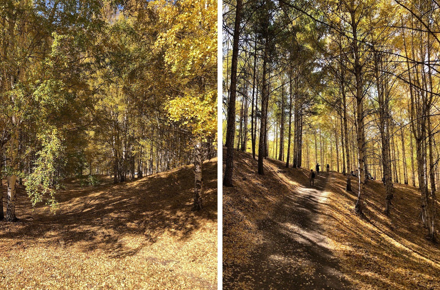
In Ala-Archa, the mountain park above Bishkek, two-thirds of the autumn colour is gold. Forty-four per cent of the forest is spruce and juniper, which stay green all year, so the gold sits among dark conifers.
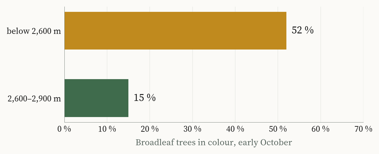
Jety-Oguz is the darkest of the nine. Seventy-two per cent of its trees are evergreen. Below 2,600 metres about half the broadleaf trees turn. Between 2,600 and 2,900 metres only 15 per cent do, because spruce fills the slopes. The gold in Jety-Oguz runs along the valley floor and stops where the spruce begins.
Gaps in the older record
The atlas goes back to 1990, and the older years have to be read with care.
In the 1990s only Landsat 5 photographed these mountains, often once or twice in an autumn month. A single picture can miss a forest’s best week entirely, so those years read lower partly because of how often the satellite passed, and the forests themselves may not have changed. From 1999 two or more satellites overlap and the record steadies. The Landsat monthly blends also read lower than the half-month Sentinel-2 numbers, so the two records cannot simply be joined into one line. In the high spruce gorges of Jety-Oguz and Salkyn-Tor, a November «peak» can be low sun and shadow on the slopes rather than leaves.
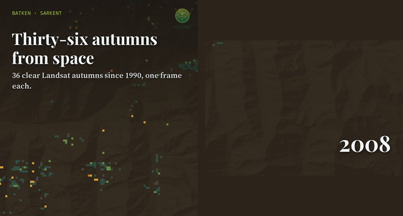
Even in the recent, well-observed years, no two autumns match. At Kyrgyz-Ata, the share of broadleaf trees in colour at the peak ranged from 63 to 99 per cent between 2018 and 2025. The dates in the table are a typical year. A real autumn can run a week or more early or late.
Some of what is on the atlas is not a measurement at all. The forest calendar, the regional ribbons and the slope diagrams show typical colours for each forest type and a descriptive mix for each region. They help a reader see why Batken’s pistachio and almond woodland reads crimson in October while Issyk-Kul and Naryn stay dark. The measured parts are the map colours, the close-up maps of each forest and the autumn charts, and the page marks which is which.
Forests in the satellite archive
Kyrgyzstan’s forests are small and scattered, nine of them spread across seven regions in this atlas alone, from the juniper woodland of Kyrgyz-Ata to the walnut groves of Arslanbob. Forests held in valleys and on sheltered slopes, shaped by height, rainfall and exposure, are a familiar pattern across the mountain countries of the region. For forests like these, the satellite archive is the one record that covers every autumn since 1990, unevenly in the early years and in detail since 2018.
Alongside the atlas we published a short film for each of the nine forests, each one built around a single question. When should we go to the walnut forest? Where are the red leaves? Why is the gold only along the river? The music in them is an original KG Labs melody for synthesised temir ooz-komuz and chopo-choor.
The autumn colours are the pleasant part of the story. The films and the atlas are also a demonstration of how KG Labs reads geospatial data with AI, and the same methods reach the harder questions about Kyrgyz forests: where forest is being lost, where it is growing back, where new trees could be planted, and how much carbon the forests hold.
Whether autumn in these forests has shifted over thirty-five years is the obvious next question. The record now exists to ask it, and the thin Landsat years of the 1990s are the part of it that will need the most care.
Aziz Soltobaev · KG Labs Public Foundation · Bishkek, 27 October 2026
Sources: autumn colour from Copernicus Sentinel-2 (2018–2025) and USGS Landsat 5, 7, 8 and 9 (1990–2025), processed by KG Labs; tree cover from ESA WorldCover 2021; elevation from Copernicus GLO-30; relief from Mapzen Terrarium elevation tiles. The full atlas is at kglabs.org/kyrgyzforestatlas.
Also in: Русский